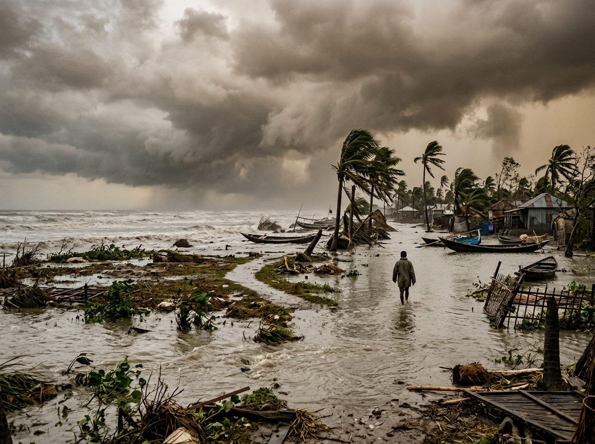
Few forces of nature demonstrate the power of Earth's atmosphere as dramatically as hurricanes, typhoons and thunderstorms.
A single thunderstorm may last less than an hour yet produce lightning, flash flooding, destructive winds, hail or a tornado. A tropical cyclone can organize over warm ocean water, grow into a vast rotating storm hundreds of miles across, remain active for days or weeks and affect several countries before finally dissipating.
These storms are different in scale, but they share a common source of energy: heat, moisture and an unstable atmosphere.
Understanding how these systems develop — and learning how to prepare for their consequences — can save lives.
For NaturePulse, these storms also represent something important to document over time. Where are storms becoming stronger? Where is rainfall increasing? Which coastlines flood repeatedly? Which forests and crops are damaged? How long does recovery take?
By combining official meteorological information with GPS-tagged community observations, photographs and long-term environmental records, NaturePulse can help create a living history of Earth's most powerful storms.
Hurricane, Typhoon or Cyclone: What's the Difference?
One of the most common questions is: *what is the difference between a hurricane and a typhoon?*
The answer is surprisingly simple. They are essentially the same type of weather system. The scientific term is tropical cyclone. Different regions use different names.
- Hurricane — generally used in the North Atlantic Ocean · Caribbean Sea · Gulf of Mexico · Eastern and Central North Pacific.
- Typhoon — used in the Western North Pacific, affecting regions such as Japan, Philippines, Taiwan, China, Vietnam and surrounding areas.
- Cyclone — commonly used in areas including the Indian Ocean · Bay of Bengal · Arabian Sea · South Pacific · Australian region.
So: Hurricane = Typhoon = Tropical Cyclone. The regional terminology changes. The underlying atmospheric phenomenon is essentially the same.
What Is a Tropical Cyclone?
A tropical cyclone is a large rotating low-pressure system that develops over warm tropical or subtropical ocean waters. The system contains thunderstorms · strong winds · heavy rainfall · low atmospheric pressure · organized circulation. When conditions remain favorable, the storm can strengthen dramatically.
How Does a Hurricane or Typhoon Form?
Several ingredients are usually necessary.
1. Warm ocean water. Tropical cyclones require warm ocean water. Warm water evaporates. The atmosphere receives large quantities of moisture. That moisture becomes fuel for thunderstorms.
2. Moist air. Warm, humid air rises. As the air rises and cools, water vapor condenses into clouds and rain. Condensation releases latent heat into the atmosphere. That heat helps warm the storm's core and encourages additional rising air. The process can become self-reinforcing.
3. Low atmospheric pressure. As air rises, surface pressure decreases. Additional air flows toward the low-pressure center. This incoming air also becomes warm and moist and begins rising. The storm starts organizing.
4. Earth's rotation. The rotation of the Earth creates the Coriolis effect. This helps cause the developing storm to rotate. Because the Coriolis effect is weak near the equator, tropical cyclones generally do not develop directly on the equator.
5. Low wind shear. Wind shear describes changes in wind speed or direction with height. Strong vertical wind shear can tear apart the organization of a developing tropical cyclone. Relatively low wind shear allows thunderstorms to remain concentrated around the circulation center.
A Tropical Cyclone's Energy Engine
*Warm ocean → evaporation → warm moist air rises → water vapor condenses → heat released → pressure falls → more moist air flows in → rotation organizes → tropical cyclone strengthens.*
This is why tropical cyclones are sometimes described as giant atmospheric heat engines.
Tropical Depression, Tropical Storm and Hurricane
A developing tropical system usually progresses through classifications according to sustained wind speed.
- Tropical depression — a closed circulation develops but maximum sustained winds remain below tropical-storm strength.
- Tropical storm — sustained winds reach tropical-storm strength. At this stage the system ordinarily receives a name.
- Hurricane / Typhoon / Cyclone — when sustained winds reach the appropriate hurricane-force threshold, the system becomes a hurricane, typhoon or equivalent regional cyclone classification.
Hurricane Categories
In the Atlantic and eastern North Pacific, hurricanes are commonly described using the Saffir-Simpson Hurricane Wind Scale.
| Category | Sustained Winds |
|---|---|
| 1 | 74–95 mph |
| 2 | 96–110 mph |
| 3 | 111–129 mph |
| 4 | 130–156 mph |
| 5 | 157 mph or higher |
Categories 3, 4 and 5 are commonly referred to as major hurricanes.
But an important warning: the category measures wind — not total storm danger. A Category 1 hurricane can still cause catastrophic flooding.
The Eye of a Hurricane
Strong tropical cyclones often develop a distinctive eye. The eye is the relatively calm region near the center. It may contain light winds · reduced cloudiness · very low atmospheric pressure.
But the eye is surrounded by the storm's most dangerous region.
The Eyewall
Around the eye is the eyewall. This ring of thunderstorms commonly contains the strongest winds · heaviest rainfall · most intense convection.
When the eye passes overhead, weather can temporarily become calm. This can be extremely dangerous because people may mistakenly believe the storm has ended. Then the opposite side of the eyewall arrives and destructive winds return — often from a different direction.
Spiral Rainbands
Long bands of thunderstorms spiral outward from the center. These rainbands can extend hundreds of miles and produce torrential rain · tornadoes · strong wind gusts · flash flooding. This means severe impacts can occur far from the hurricane's eye.
How Large Can Hurricanes Become?
A hurricane is not simply a large tornado. The two phenomena are dramatically different. A tornado may have an intense circulation only hundreds of meters wide. A tropical cyclone may stretch hundreds of miles across. Its rainfall can affect entire states, provinces or countries.
Large hurricanes can produce dangerous conditions long before the center reaches land.
Hurricane Wind Damage
Hurricane-force winds can remove roofs · collapse weak buildings · break windows · uproot trees · damage power lines · destroy signs · damage communication towers · overturn vehicles · destroy crops.
Flying debris becomes extremely dangerous. As with tornadoes, building construction and roof connections are crucial.
But Water Often Causes More Death and Destruction
Many people think primarily about hurricane winds. Yet water can be the greatest threat. A tropical cyclone can produce several types of dangerous flooding: storm surge · coastal waves · heavy rainfall · flash flooding · river flooding. Each behaves differently.
What Is Storm Surge?
Storm surge is an abnormal rise of seawater generated primarily by the storm's winds pushing ocean water toward the coast. It can flood beaches · coastal roads · houses · hotels · ports · islands · estuaries · river mouths.
Water can move inland rapidly. A storm surge can be deadly even if the building survives the wind.
Storm Surge Is Not the Same as a Tsunami
A tsunami is generally caused by sudden displacement of water from an earthquake · landslide · volcanic activity. Storm surge is caused primarily by a storm's winds and pressure effects. Both can flood coastlines, but their physical origins are different.
High Tide Can Make Storm Surge Worse
The final water level depends partly on the astronomical tide. A significant storm surge arriving during high tide can produce greater coastal inundation. Large waves riding on top of elevated water can increase structural damage even further.
Heavy Rain Can Extend Far Inland
A hurricane does not need to remain a hurricane to be deadly. After landfall, tropical cyclones often weaken because they lose access to warm ocean energy. But enormous quantities of moisture may continue moving inland. This can cause disastrous rainfall hundreds of miles from the coast.
Mountainous terrain can make the problem worse by forcing moist air upward, increasing rainfall.
Flash Floods
Flash floods can develop rapidly when intense rainfall overwhelms streams · drainage systems · urban streets · mountain valleys. Floodwater can move with tremendous force. Even relatively shallow moving water can sweep away people or vehicles.
Never assume a flooded road is safe because another vehicle crossed successfully.
River Flooding
Large storm systems can saturate enormous watersheds. Rivers may continue rising after the storm itself has moved away. Communities can therefore experience major flooding days after landfall.
Hurricanes Can Produce Tornadoes
Tropical cyclones can also produce tornadoes. These often develop within rainbands, particularly on portions of the storm where atmospheric conditions favor rotating thunderstorms. Therefore people hundreds of miles from the coastline may receive tornado warnings while the larger hurricane system passes through.
Lightning in Tropical Cyclones
Hurricanes contain enormous thunderstorms, but lightning patterns can vary considerably. Some intense tropical cyclone regions produce less lightning than ordinary continental thunderstorms because their internal vertical temperature structures differ. Nevertheless, thunderstorms within outer rainbands can certainly generate lightning.
Major Hurricane Regions of the World
Tropical cyclones affect many parts of the globe.
Atlantic Ocean
Atlantic hurricanes can threaten the Caribbean · Gulf Coast of the United States · Florida · Eastern United States · Mexico · Central America · Bermuda · Atlantic Canada. Occasionally remnants can reach Europe.
Caribbean
Caribbean islands can be particularly vulnerable because communities are surrounded by coastline · evacuation options may be limited · ports and airports can be disabled · imported food and fuel supplies can be disrupted. A major hurricane can affect an island's entire economy.
Gulf of Mexico
The Gulf Coast is vulnerable to storm surge · hurricanes · industrial damage · oil and gas infrastructure disruption · coastal flooding. Important risk areas include Texas, Louisiana, Mississippi, Alabama, Florida and Mexico.
Western Pacific: Typhoon Country
The western North Pacific is one of the world's most active tropical cyclone regions. Typhoons regularly threaten the Philippines, Taiwan, Japan, China, Vietnam, South Korea and Pacific islands. Some western Pacific storms become extraordinarily intense.
- Philippines — particularly exposed because of its position within the western Pacific cyclone belt. Many tropical cyclones pass through or close to the country. Consequences can include wind destruction · storm surge · landslides · flooding · agricultural damage. Island geography makes recovery particularly challenging after widespread infrastructure damage.
- Japan — faces typhoons · heavy rainfall · landslides · river flooding · coastal flooding. Japan's engineering and warning systems reduce vulnerability, but powerful storms can still cause severe disruptions.
- China — densely populated southeastern coastline is vulnerable to typhoons. Major urban areas, ports, industrial regions and agricultural districts can all be affected.
- Vietnam — long coastline makes the country particularly exposed. Typhoons can produce coastal damage while mountainous terrain increases inland flood and landslide risks.
Bay of Bengal Cyclones
The Bay of Bengal has produced some of the deadliest tropical cyclone disasters in history. Countries vulnerable include Bangladesh, India, Myanmar, Sri Lanka. The combination of warm water + low-lying coastlines + high population density + river deltas can make storm surge extraordinarily dangerous.
Bangladesh and Cyclone Risk
Much of Bangladesh consists of low-lying deltaic land. Historically, severe cyclones produced enormous loss of life. Improvements including early warnings · evacuation · cyclone shelters · community preparedness have saved many lives during more recent storms. This demonstrates that disaster risk can be reduced even when the natural hazard remains.
India and Tropical Cyclones
India is exposed on both sides.
Bay of Bengal Coast — particularly vulnerable states include Odisha · West Bengal · Andhra Pradesh · Tamil Nadu.
Arabian Sea Coast — cyclones may affect Gujarat · Maharashtra · Goa · Karnataka · Kerala.
Historically, the Bay of Bengal has produced more tropical cyclones than the Arabian Sea, although damaging Arabian Sea cyclones occur and deserve close attention.
Kerala and Tropical Storm Effects
Kerala does not receive direct cyclone landfalls as frequently as some eastern Indian states, but tropical systems can still influence heavy rain · strong winds · coastal erosion · rough seas · flooding · landslides. A cyclone hundreds of kilometers away can influence local weather significantly.
Arabian Sea Cyclones
The Arabian Sea affects western India · Pakistan · Oman · Yemen · the Arabian Peninsula. Intense cyclones have occasionally produced serious disasters in regions that historically perceived tropical cyclone risk as relatively low.
Indian Ocean and East Africa
Cyclones can affect Madagascar · Mozambique · Mauritius · Réunion · Tanzania · Seychelles · Comoros. Mozambique and Madagascar are particularly vulnerable to destructive tropical systems.
Australian Region
Australia experiences tropical cyclones along its northern coastlines. Regions affected include Queensland · Northern Territory · Western Australia. Australian tropical cyclones can produce extreme wind · storm surge · flash flooding · agricultural losses.
South Pacific
Island nations such as Fiji, Vanuatu, Tonga, Samoa can experience severe tropical cyclone impacts. Small island countries face special problems because a single powerful cyclone may affect a large proportion of national infrastructure.
Some of History's Most Destructive Tropical Cyclones
Major tropical cyclone disasters demonstrate that wind speed alone does not determine the outcome. Death toll and economic impact depend on population · storm surge · rainfall · housing · warning · evacuation · geography.
The 1970 Bhola Cyclone
The Bhola Cyclone struck the region that is now Bangladesh. It is regarded as one of history's deadliest tropical cyclones. Storm surge devastated low-lying communities and killed hundreds of thousands of people. The disaster demonstrated the extreme vulnerability of densely populated river deltas.
Hurricane Katrina — 2005
Hurricane Katrina struck the U.S. Gulf Coast and became one of the most consequential disasters in American history. New Orleans experienced catastrophic flooding following failures in the levee and flood-protection system.
Katrina demonstrated that a hurricane disaster can become an infrastructure disaster. The consequences involved flooding · evacuation · housing · healthcare · transportation · poverty · emergency management.
Hurricane Harvey — 2017
Harvey demonstrated another type of hurricane hazard: extraordinary rainfall. The storm stalled near Texas, producing devastating flooding. It illustrated why focusing only on hurricane category can be misleading.
Hurricane Maria — 2017
Maria devastated Puerto Rico and other Caribbean areas. Beyond immediate wind damage, the disaster demonstrated the long-term consequences of electrical-grid failure · communication disruption · healthcare interruption · water-system damage. Recovery lasted far longer than the storm itself.
Typhoon Haiyan — 2013
Typhoon Haiyan, known as Yolanda in the Philippines, became one of the most powerful tropical cyclones to make landfall in modern records. Its storm surge devastated coastal communities including Tacloban. Haiyan demonstrated how extremely intense winds combined with coastal geography can produce catastrophic conditions.
Tropical Cyclones and Climate Change
The relationship between global warming and tropical cyclones requires careful explanation. There is strong physical reason to expect warming oceans and a warmer atmosphere to influence tropical cyclones.
Scientists investigate changes in maximum intensity · rainfall · rapid intensification · storm tracks · sea-level-related storm surge · overall frequency.
The clearest concern is not necessarily that every ocean basin will experience dramatically more storms. Rather, a warmer climate can influence how intense, wet and damaging certain storms become.
Warmer Oceans
Tropical cyclones obtain energy from warm ocean water. When deeper layers of ocean water are warm, storms may have greater potential to maintain or increase intensity.
A Warmer Atmosphere Holds More Moisture
A warmer atmosphere can contain more water vapor. This can contribute to heavier rainfall during tropical cyclones. That means rainfall and flooding risks can increase even independently of changes in wind intensity.
Sea-Level Rise Makes Storm Surge More Dangerous
Suppose an identical hurricane strikes the same coastline decades apart. If the background sea level has risen, the storm surge begins from a higher starting point. This means areas that previously remained dry may flood.
Climate-related sea-level rise therefore increases coastal vulnerability even if the storm itself has not changed.
Rapid Intensification
One of the most concerning hurricane behaviors is rapid intensification. A storm can strengthen dramatically within a relatively short period. If this happens near landfall, communities may have less time than expected to prepare for a much stronger storm. Warm ocean conditions can contribute to environments favorable for rapid strengthening.
Hurricanes Weaken Over Land
Once a tropical cyclone moves over land, it usually weakens because it loses access to its warm-ocean energy source. Land also increases friction and disrupts circulation.
But weakening winds do not mean the danger is over. Rainfall, flooding and tornadoes may continue.
What Is a Thunderstorm?
A thunderstorm is a convective storm containing lightning and thunder. Thunderstorms develop when warm moist air rises into an unstable atmosphere. As air rises and cools, moisture condenses into clouds. If the atmosphere is sufficiently unstable, these clouds can grow vertically into cumulonimbus clouds. These towering clouds can extend many kilometers upward.
Three Stages of a Typical Thunderstorm
- Developing stage — warm air rises. The storm is dominated by updrafts. Clouds grow vertically.
- Mature stage — rain and hail begin falling. Both updrafts and downdrafts exist. *This is often the storm's most dangerous stage.* Lightning, heavy rain, strong wind and hail may occur.
- Dissipating stage — downdrafts dominate. The storm loses its supply of warm rising air. Rain gradually weakens.
Thunderstorms Can Be Ordinary — or Extremely Dangerous
Some thunderstorms produce little more than rain · lightning · brief gusty winds. Others become severe and produce large hail · destructive winds · flash floods · tornadoes.
A single thunderstorm can become a billion-dollar disaster if it crosses a densely developed region with large hail or destructive winds.
Types of Thunderstorms
Several broad types exist:
- Single-cell thunderstorm — usually short-lived.
- Multi-cell storm — several storm cells develop and interact.
- Squall line — a long line of thunderstorms capable of producing widespread destructive winds.
- Supercell — a highly organized thunderstorm with a rotating updraft. Supercells are particularly associated with large hail · tornadoes · severe wind.
Lightning
Lightning is one of the most dangerous components of thunderstorms. It is a massive electrical discharge within clouds · between clouds · between cloud and ground.
A lightning channel heats the surrounding air extraordinarily rapidly. The rapid expansion produces thunder.
Why We See Lightning Before Hearing Thunder
Light travels vastly faster than sound. Therefore flash comes first. Thunder arrives afterward. The delay can provide a rough estimate of the distance to the lightning.
But the safest rule is simpler: if you can hear thunder, you are close enough to be struck by lightning.
Lightning Can Strike Away From Heavy Rain
People sometimes assume they are safe because *"it's not raining here."* Lightning can strike several miles away from the core of a thunderstorm. Do not wait for rain before seeking shelter.
Safe Shelter During Lightning
The safest common options are a substantial enclosed building or fully enclosed hard-topped vehicle.
Avoid trees · open fields · beaches · boats · golf courses · metal fences · open shelters. A picnic shelter does not necessarily provide lightning protection.
Hail
Powerful thunderstorm updrafts can carry ice particles repeatedly through extremely cold parts of a cloud. Layers of ice accumulate. Eventually the hailstone becomes too heavy for the updraft and falls.
Large hail can damage roofs · break windows · destroy crops · damage aircraft · injure livestock · injure people · destroy vehicles.
Straight-Line Winds
Not all destructive thunderstorm winds are tornadoes. Powerful downdrafts can spread outward upon reaching the ground. These straight-line winds can exceed hurricane force and damage enormous areas.
Downbursts and Microbursts
A strong concentrated downdraft can create a downburst. A smaller-scale event is called a microburst.
Microbursts are particularly dangerous to aircraft during takeoff and landing because they can cause rapid changes in wind direction and speed.
Derechos
A derecho is a widespread, long-lived windstorm associated with a fast-moving line of thunderstorms. Derechos can produce destructive winds across hundreds of miles. They may damage forests · crops · power infrastructure · buildings over a much larger area than a typical tornado.
Flash Flooding From Thunderstorms
Thunderstorms can produce extraordinary rainfall rates. Urban areas are particularly vulnerable when water cannot infiltrate paved surfaces quickly enough. Mountain valleys, canyons and dry washes can flood extremely rapidly.
Never camp or remain in a normally dry channel when severe thunderstorms are possible upstream.
Thunderstorms Over Mountains
Mountain terrain can help trigger thunderstorms by forcing warm moist air upward. Mountain storms can develop rapidly. Hikers may find themselves exposed above the tree line. Anyone hiking in thunderstorm-prone mountains should pay close attention to forecasts and avoid exposed ridges during lightning.
How to Survive a Hurricane
Preparation must begin before the storm arrives.
Know Whether You Are in an Evacuation Zone
Coastal residents should know their storm-surge zone · evacuation route · shelter location. Do not assume a strong house makes it safe to remain in a mandatory evacuation area. Storm surge can destroy or inundate structurally sound buildings.
Evacuate When Authorities Tell You To
Do not wait until water begins rising. Roads may become flooded · congested · blocked · closed. Fuel may become unavailable. Evacuating early is far safer.
Prepare an Emergency Kit
Consider supplies including drinking water · shelf-stable food · medications · first aid · flashlights · batteries · power banks · weather radio · important documents · cash · hygiene products · pet supplies. Prepare for extended power outages.
Protect Windows and Doors
Use appropriately rated storm shutters · impact-resistant windows · reinforced doors. Do not rely on tape across windows. Tape does not make ordinary glass hurricane-proof.
Garage Doors Matter
Garage doors can be major structural vulnerabilities. If a garage door fails, wind can enter the structure and increase pressure on walls and the roof. Properly rated wind-resistant doors are important in hurricane-prone areas.
Strong Roof Connections
Hurricane-resistant construction emphasizes roof → walls → foundation using a continuous load path. Connections may include structural straps · clips · anchors · reinforced framing. The goal is to prevent different parts of the structure from separating during extreme wind.
Hurricane-Resistant Homes
A more resilient home may incorporate reinforced roof connections · impact-resistant openings · strong garage doors · proper foundation anchoring · wind-rated roofing · elevated construction in flood zones · flood-resistant lower levels · backup power · drainage · safe room.
Building codes should reflect the local hazard.
Elevating Buildings in Flood Zones
In areas vulnerable to storm surge or river flooding, strengthening walls alone is not enough. Buildings may need to be elevated above expected flood levels. Utilities such as electrical equipment · HVAC systems · generators should also be placed where floodwater is less likely to reach them.
Don't Use a Generator Indoors
After hurricanes, carbon monoxide poisoning from generators can become a serious cause of injury and death. Generators should never be operated inside homes · garages · basements. They must be positioned outdoors according to manufacturer and safety guidance, well away from openings.
Never Walk or Drive Through Floodwater
Floodwater can hide washed-out roads · debris · open manholes · electrical hazards · strong currents. Vehicles can float surprisingly easily. Turn around rather than entering unknown floodwater.
After a Hurricane
Post-storm dangers can include downed power lines · contaminated water · gas leaks · mold · structural instability · floodwater · heat · carbon monoxide · damaged trees · displaced wildlife. Recovery can remain dangerous long after the sky becomes clear.
Protecting Agriculture
Tropical cyclones and severe thunderstorms can devastate farms. Damage may include crop lodging · fruit drop · saltwater intrusion · livestock losses · soil erosion · irrigation damage · greenhouse destruction · stored-food losses.
Agricultural disaster planning can include drainage · windbreaks · crop diversification · backup water/power · secure storage · livestock evacuation plans.
Forests and Hurricanes
Major hurricanes can transform forests. Strong winds may defoliate trees · snap trunks · uproot mature trees · open the forest canopy. This changes sunlight · moisture · habitat · fire risk · species composition.
Forest recovery can take decades.
Mangroves and Wetlands
Natural coastal ecosystems can provide important protective benefits. Mangroves, wetlands, dunes and reefs can absorb portions of wave energy · storm surge · erosion. They are not substitutes for evacuation or engineered protection, but destroying natural coastal barriers can increase vulnerability.
Coral Reefs
Hurricanes and typhoons can physically damage coral reefs. Strong waves can break corals · move sediment · alter reef structure. However, tropical ecosystems have evolved with storms, and recovery may occur depending on storm severity and other stresses.
Wildlife
Storms can destroy nests · displace birds · flood habitats · change food supplies · move marine organisms · create temporary wetlands. Animals may appear in unusual locations after storms. NaturePulse observations could document these changes.
Birds and Hurricanes
Migratory birds sometimes become entrained in storm circulation and appear far from their usual locations. Bird observations before and after tropical cyclones could become particularly interesting NaturePulse records.
Coastline Changes
Powerful storms can dramatically reshape beaches. They may remove dunes · create new inlets · deposit sand elsewhere · destroy vegetation · expose buried structures. Repeated GPS photographs from the same coastline could show these changes clearly.
NaturePulse Hurricane and Typhoon Observations
NaturePulse should create a structured storm-event record. Example: Storm name · official identifier · ocean basin · start date · end date · maximum intensity · maximum wind · minimum pressure · track · landfalls. Then connect citizen observations.
What Users Could Report
Before the storm — sky · waves · wind · coastal conditions · preparations · river levels.
During the storm — only from safe shelter: rain · wind sound · power outage · flood level. Never encourage people to leave shelter to collect observations.
After the storm — fallen trees · flooding · erosion · crop damage · forest damage · wildlife · landslides · building damage · river changes.
NaturePulse Thunderstorm Observation
Capture GPS · date · time · temperature · rainfall if known · lightning · thunder · hail · strong wind · flooding · tornado · cloud formations · photos · video · audio.
People could even upload recordings of thunder · hail · wind · heavy rain.
Document Hail Size
NaturePulse could provide easy reference categories: pea · marble · coin · golf ball · tennis ball. But whenever safe, actual measured diameter is better. Never ask people to go outside during active hail to collect stones.
Document Rainfall
Users with rain gauges could submit rainfall amount · measurement period · gauge type. Then NaturePulse could compare citizen measurements with nearby official stations.
Flood-Level Photography
After the area is safe, a photograph containing recognizable landmarks can become valuable. Record GPS · date · time · approximate water depth · river/stream name. Then return after 24 hours · one week · one month and document recession and recovery.
Storm Event vs. Individual Observation
NaturePulse should maintain one master event. *Example: Hurricane Example — September 2030.* Connected records might include official storm track · 3,000 citizen observations · rainfall measurements · flood photographs · coastal erosion · wildlife observations · crop losses · news reports · government reports · recovery photos. One storm. Thousands of linked observations.
Before-and-After Photography
This can become one of NaturePulse's most valuable functions. Consider photographing the same beach · tree · forest · river · farm · wetland *before* a hurricane. Then *after.*
NaturePulse could display BEFORE ↔ AFTER. Then 1 year later. 5 years later. The immediate disaster becomes a long-term environmental record.
Global Storm Archive
Eventually users could search hurricanes in Florida · typhoons in Philippines · cyclones in Odisha · thunderstorms in Kerala · hail in Texas · flooding after hurricanes · mangrove damage · crop loss — and view observations by year.
Artificial Intelligence Could Connect the Data
NaturePulse AI could recognize that *263 users reported coastal flooding within the same geographic area.* Then correlate those observations with storm track · rainfall · official storm surge · elevation · land use. Over decades, this could help communities see recurring patterns.
Climate Trends Require Long-Term Records
One hurricane cannot prove climate change. One extraordinary thunderstorm cannot prove a new climate pattern. But decades of systematically collected information can reveal changes in seasonal timing · intensity · rainfall · flood extent · coastal erosion · recovery. This is why preserving observations matters.
NaturePulse Safety Principle
Place this message prominently on every severe-weather page:
> ⚠️ Observe Nature — Never Challenge It.
>
> Do not go outside during a hurricane, typhoon, severe thunderstorm, lightning event, flash flood or tornado merely to obtain photographs or videos. Follow official warnings and evacuation instructions. Your safety always comes before the observation.
Hurricanes, Typhoons and Thunderstorms Are Part of the Same Atmospheric Story
A thunderstorm can exist for less than an hour. A hurricane can contain thousands of thunderstorms and survive for days. Both demonstrate the extraordinary movement of heat, moisture, air and energy through the atmosphere.
They provide rain that ecosystems need. But under extreme conditions they can also become disasters.
We cannot prevent them. But humanity can become better at forecasting · warning · evacuating · building · protecting ecosystems · recording impacts · learning from previous events.
And every storm leaves information behind. A tree blown down. A beach reshaped. A river overflowing. A farm destroyed. A mangrove forest protecting a village. A new inlet created. A bird appearing far from its normal range. Each can become a NaturePulse observation.
NaturePulse.net — Observe · Document · Understand · Prepare · Preserve
The storm may pass in hours. The changes it creates can last for generations.
By documenting hurricanes, typhoons and thunderstorms safely and systematically, NaturePulse can help build a permanent global memory of how our atmosphere affects people, wildlife, agriculture and the landscapes we share.