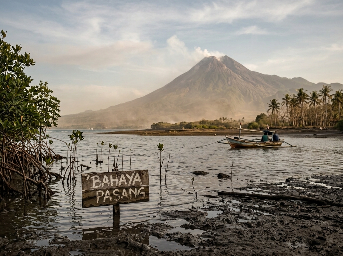
Indonesia is one of the most extraordinary countries on Earth.
More than 17,000 islands stretch between the Indian and Pacific Oceans. Tropical forests cover vast landscapes. Volcanoes rise above densely populated agricultural valleys. Coral reefs surround islands. Peatlands store enormous quantities of carbon. Rice fields, fisheries, plantations and forests support hundreds of millions of people.
But Indonesia's geography also places it at the intersection of some of the greatest environmental challenges of the twenty-first century.
The country must simultaneously deal with global warming · rising seas · sinking cities · extreme rainfall · drought · floods · forest and peat fires · deforestation · agricultural pressure · palm-oil expansion · air pollution · earthquakes · tsunamis · volcanic eruptions.
Few countries illustrate more clearly how climate risk, land use, urban growth and geological hazards can overlap.
Indonesia's challenge is therefore not merely how to reduce greenhouse-gas emissions. It is: how can one of the world's largest and most geographically complex nations continue developing while protecting its people, food supply, forests, water and extraordinary biodiversity?
Jakarta: A Megacity That Is Literally Sinking
Perhaps no Indonesian environmental story has attracted more global attention than Jakarta.
Jakarta is a huge coastal metropolis built around rivers, canals and low-lying land beside Jakarta Bay. It has always been vulnerable to flooding.
But today several problems are combining — land subsidence · sea-level rise · heavy rainfall · loss of natural drainage · rapid urbanization · groundwater extraction — to create an increasingly difficult future.
Jakarta's Biggest Problem Is Not Sea-Level Rise Alone
Jakarta is often described simply as *"the city sinking because of climate change."* That is incomplete.
Climate-driven sea-level rise certainly increases the city's long-term coastal risk. But in some parts of Jakarta, the land itself has historically been sinking much faster than global sea level is rising.
A major reason is excessive groundwater extraction. Where households, businesses and industries lack sufficient piped water, groundwater is pumped from underground aquifers. Removing that water can cause layers of sediment to compact. The land above sinks.
The World Bank has reported that parts of North Jakarta have historically experienced subsidence on the order of 15–25 centimeters per year, with excessive deep groundwater extraction identified as a major cause. In some coastal areas, decades of subsidence have lowered the land by several meters. *(World Bank)*
That is an extraordinary transformation within a human lifetime.
When the Land Goes Down and the Sea Goes Up
Jakarta faces a particularly dangerous combination: the ocean is gradually rising while parts of the city are sinking. This increases the relative height of the sea compared with streets, houses, businesses and infrastructure.
The result is greater vulnerability to tidal flooding · storm surge · river flooding · drainage failure · saltwater intrusion · coastal inundation.
The World Bank estimates that around 42 million Indonesians live less than 10 meters above sea level, illustrating that coastal vulnerability extends far beyond Jakarta.
Jakarta's Rivers Create Another Challenge
Thirteen major rivers flow through Jakarta toward the Java Sea. During intense rainfall, enormous quantities of water must pass through a heavily urbanized landscape.
But cities change natural hydrology. Forests, wetlands and agricultural land that once absorbed rainfall become roads · buildings · parking areas · concrete. Water runs off these surfaces rapidly instead of soaking into the ground. Drainage channels can also become blocked by sediment and waste.
The result is rain from above + rivers from inland + sea from the coast all competing for somewhere to go.
Climate Change Makes the Problem Harder
A warmer climate can intensify heavy rainfall in many regions because warmer air can contain more moisture. At the same time, global sea level is rising.
For Jakarta, climate change therefore adds additional pressure to a city already struggling with subsidence · flooding · drainage · water supply · urban congestion.
The lesson is important: climate change often does not create a problem from nothing. It makes an existing vulnerability worse.
The Long-Term Solution Must Include Water
Jakarta cannot solve subsidence simply by building higher sea walls. If groundwater extraction continues aggressively, the land can continue sinking behind the defenses.
The World Bank has emphasized that a longer-term response requires expansion of reliable piped water and better integrated water-resource and urban planning — not simply flood barriers.
This is a crucial lesson for rapidly growing cities around the world. Water supply is also climate infrastructure.
Indonesia Decided to Build a New Capital
Against this backdrop, Indonesia made one of the most ambitious urban-development decisions of modern times: build a new national capital.
The new capital is called Nusantara or Ibu Kota Nusantara — IKN. It is being developed in East Kalimantan on the island of Borneo, geographically known in Indonesia as Kalimantan. The location lies between the established cities of Balikpapan and Samarinda.
Is Indonesia Abandoning Jakarta?
No. Jakarta will remain one of Indonesia's largest and most important economic and commercial centers. Moving the national capital does not mean relocating Jakarta's entire metropolitan population. The plan is primarily to move central government functions progressively to Nusantara.
And as of 2026, the transfer is still a developing process rather than a completed move. Indonesia's Nusantara Capital Authority says the first construction phase, covering 2022–2024, has been completed and the project is now in its 2025–2029 second phase. It also notes that the formal declaration of the capital transfer ultimately requires a presidential decree. *(IKN)*
Development continues. The authority reported in May 2026 that committed investment had reached approximately Rp72.39 trillion.
Why Move the Capital?
Jakarta's environmental vulnerability is one factor — but not the only factor. The move is also intended to reduce concentration of government functions on Java · encourage development in other parts of Indonesia · reduce pressure on Jakarta · create a planned administrative center · build a modern smart city · distribute economic activity more evenly.
Indonesia is extraordinarily Java-centric. Java contains only a fraction of Indonesia's land area but a very large share of its population and economic activity.
Moving the capital to Kalimantan represents an attempt to rebalance the geography of government.
Nusantara: A Green City — or Another Environmental Challenge?
The government presents Nusantara as a smart, green and sustainable city. The official vision includes extensive natural space, ecosystem conservation, renewable energy and a goal of reaching net-zero emissions by 2045.
That is an ambitious objective. But constructing a new city inside Borneo also creates legitimate environmental questions.
Borneo is one of Earth's great biodiversity centers. Its forests support species including orangutans · proboscis monkeys · hornbills · sun bears · clouded leopards · thousands of plant species.
Large-scale urban development requires roads · housing · water · electricity · construction materials · transportation · new economic activity.
The critical question is therefore: can Indonesia actually build the green city it promises without triggering additional forest fragmentation and development pressure?
The success of Nusantara should ultimately be judged not by architectural renderings but by measurable outcomes over decades.
Borneo Is Already Under Environmental Pressure
Borneo's forests have experienced extensive logging, plantation development, mining and fires. Indonesia has made significant efforts in recent years to reduce deforestation compared with some earlier periods, but pressure remains.
A new capital can potentially concentrate development in a carefully planned footprint. Or, if poorly controlled, roads and economic expansion surrounding the city could increase land conversion elsewhere.
NaturePulse-style long-term GPS observation could be particularly valuable here: forest before construction → construction → urban expansion → wildlife changes → restoration.
Palm Oil: An Economic Giant and Environmental Controversy
Indonesia is the world's dominant palm-oil producer. Palm oil is used in an extraordinary range of products — cooking oil · margarine · bakery products · snacks · cosmetics · soap · detergents · industrial products · biofuels.
Oil palm is highly productive compared with many other vegetable-oil crops. That efficiency is important.
The environmental problem is not simply *"palm oil is bad."* The central question is: where and how is it grown?
Why Palm Oil Expanded So Rapidly
Oil palm thrives in warm, humid tropical environments. Indonesia offers ideal growing conditions. The industry provides export income · employment · smallholder livelihoods · domestic cooking oil · industrial raw materials.
Millions of Indonesians are economically connected to palm oil directly or indirectly. Therefore, eliminating the industry is neither simple nor necessarily desirable.
The challenge is making production sustainable without continuously clearing valuable ecosystems.
When Forest Becomes Plantation
One of the greatest environmental concerns has been conversion of tropical forest to plantation land.
Natural rainforest can contain an extraordinary diversity of trees · mammals · birds · insects · fungi · soil organisms.
An oil-palm plantation may still contain vegetation, but it does not reproduce the ecological complexity of primary rainforest.
Loss of forests can contribute to biodiversity decline · carbon emissions · habitat fragmentation · soil changes · water-cycle changes.
Particularly serious is the conversion of peatland.
Indonesia's Peatlands Are Global Carbon Vaults
Peatlands form where partially decomposed vegetation accumulates over centuries or thousands of years in waterlogged soils. The soil can become extremely carbon-rich.
Healthy wet peat can store enormous amounts of carbon.
But when peat is drained for plantation agriculture or other development:
*water table falls → peat dries → carbon oxidizes → carbon dioxide enters atmosphere*
and fire risk rises dramatically.
FAO notes that Indonesian peatlands are among the world's major tropical peat systems and that when they are drained, degraded or burned they can become large sources of emissions, fires and haze. *(FAO)*
Peat Fires Are Not Ordinary Forest Fires
Peat can burn underground. A fire may continue smoldering beneath the surface and become difficult to extinguish. Smoke can contain enormous quantities of particulate pollution.
During severe fire years, haze has spread across national borders into Malaysia, Singapore and other neighboring regions — creating an international pollution problem.
The 2015 Fire Disaster
Indonesia's 2015 forest and peat fires demonstrate the scale of the problem. FAO cites World Bank estimates indicating that approximately 2.6 million hectares burned, generating economic losses of around US$16.1 billion.
The smoke damaged health · closed schools · disrupted transportation · reduced agricultural production · released enormous quantities of greenhouse gases.
This demonstrates another feedback:
*Forest destruction → peat drainage → drought → fire → carbon emissions → climate warming → potentially greater future fire risk.*
El Niño Can Make Indonesian Fires Worse
Indonesia's rainfall varies with large-scale climate patterns. During strong El Niño periods, parts of Indonesia can become unusually dry. Dry conditions increase fire risk.
Research on Borneo has found strong links between drought during El Niño periods, industrial land conversion and increased fire activity. *(CIFOR-ICRAF)*
Climate variability and land management therefore interact. A healthy wet peatland may resist fire. A drained peatland during drought can become extraordinarily vulnerable.
Rewetting Peatlands
One of Indonesia's important climate strategies is: keep peat wet.
Restoration can involve blocking drainage canals · raising groundwater levels · restoring vegetation · monitoring moisture · preventing fires · supporting economic activities compatible with wet peat.
FAO's 2026 work in Indonesia highlights groundwater monitoring as a crucial tool because restoration success depends not merely on tree cover but on maintaining the hydrology beneath the surface.
Agriculture Beyond Palm Oil
Indonesia's agricultural system is extremely diverse. Major products include rice · maize · cassava · soybeans · coffee · cocoa · rubber · coconut · palm oil · fruits · vegetables · spices. Indonesia also has enormous fisheries and aquaculture sectors.
Climate change threatens different crops in different ways.
Rice and Climate
Rice is fundamental to Indonesian food culture and food security. Rice farming depends heavily on reliable water. Climate variability can change planting dates · water availability · harvest timing · pest pressure · yield.
Drought caused by the 2023 El Niño delayed and reduced rice harvests entering early 2024 and contributed to higher food prices.
This illustrates how a weather event can move through an entire economic chain:
*drought → lower/delayed harvest → reduced supply → higher rice price → household food costs rise.*
The Situation Can Reverse Quickly
Indonesia can then move from drought to excessive rainfall. FAO's January 2026 assessment found favorable national rice prospects overall, yet also documented localized crop losses from floods and landslides in Aceh, North Sumatra and West Sumatra, while some other areas had recently experienced below-average rainfall.
That is the Indonesian climate challenge in one example: one region is too dry while another is flooded.
Small Farmers Are Especially Vulnerable
Smallholders may have limited access to irrigation · insurance · credit · weather forecasts · improved seeds · storage · machinery. One failed crop can cause substantial financial hardship.
In April 2026, Indonesia and UN agencies launched a program intended to train at least 15,000 farmers in East Java and Lampung in climate-smart agricultural practices, including water-saving rice approaches and improved access to climate finance.
This kind of adaptation will become increasingly important.
Indonesia Needs Climate-Smart Agriculture
Possible strategies include better irrigation · water-saving rice cultivation · drought-tolerant varieties · flood-tolerant crops · improved weather forecasting · crop diversification · soil restoration · agroforestry · integrated pest management · farmer insurance · better post-harvest storage.
There is no single agricultural solution for an archipelago spanning thousands of kilometers. Solutions must be local.
Pollution Is More Than Smoke
Indonesia faces several other pollution challenges:
- Urban air pollution — traffic, industry, power generation and fires contribute to poor air quality in some metropolitan regions.
- River pollution — untreated sewage, household waste and industrial discharge can contaminate waterways.
- Plastic pollution — as an island nation with enormous river systems and coastlines, plastic leakage into the marine environment is a major concern.
- Mining pollution — mining can affect rivers, forests and local ecosystems if poorly controlled.
Indonesia's Rivers Carry the Story Downstream
Pollution from inland cities and industries eventually reaches:
*rivers → estuaries → mangroves → coral reefs → ocean.*
This is why land and marine conservation cannot be separated. A plastic bottle discarded hundreds of kilometers inland can eventually reach the sea. Nature operates as a connected system.
Indonesia Is Also One of Earth's Great Geological Hotspots
Climate risk is only half of Indonesia's environmental story. The country sits along the Pacific Ring of Fire.
USGS describes the Ring of Fire as a belt of frequent earthquakes and volcanic eruptions surrounding the Pacific, extending through Indonesia.
Indonesia lies at the meeting of several major and smaller tectonic plates. In eastern Indonesia especially, the tectonic geometry becomes exceptionally complex as Australian, Pacific-region and Sunda-related plates interact.
This produces earthquakes · volcanoes · tsunamis · mountain building.
The Same Geology That Creates Danger Also Creates Indonesia
Indonesia's volcanic islands exist partly because of tectonic processes. Subduction occurs where one tectonic plate moves beneath another. Rock melts. Magma rises. Volcanoes form.
The process creates mountains · islands · fertile volcanic soils — but also eruptions · earthquakes · tsunamis.
Indonesia therefore literally exists because of the geological processes that threaten it.
Volcanoes and Agriculture
Volcanic eruptions are destructive. But volcanic material can eventually weather into highly fertile soil. This is one reason dense agricultural communities developed around volcanoes on islands such as Java.
Farmers accept a difficult relationship: the volcano that threatens the village can also create the soil that makes the village productive.
Mount Merapi
Mount Merapi near Yogyakarta is one of Indonesia's most famous and active volcanoes. It stands close to densely populated agricultural communities.
Hazards can include lava · pyroclastic flows · ash · rockfalls · lahars.
Merapi remained actively erupting during 2026. The Smithsonian/USGS Global Volcanism Program reported continuing lava avalanches and pyroclastic flows in August 2026, with Indonesian authorities maintaining Alert Level 3 and exclusion zones extending several kilometers from the summit depending on direction. *(Smithsonian Global Volcanism)*
This is not simply a historical hazard. It is an ongoing part of life in Indonesia.
Pyroclastic Flows: Among Nature's Most Dangerous Events
A pyroclastic flow is a rapidly moving mixture of hot gas · ash · rock · volcanic debris. It can travel down a volcano at tremendous speed.
Survival inside a major pyroclastic flow is extremely unlikely. The appropriate strategy is evacuate before it arrives.
Lahars
Volcanic ash mixed with water can create fast-moving mudflows called lahars. Heavy tropical rainfall can mobilize volcanic deposits months or even years after an eruption.
A river valley below a volcano may therefore remain hazardous long after visible eruptive activity subsides.
Indonesia's Earthquake Risk
Earthquakes occur because tectonic plates continually move. Indonesia experiences both large offshore subduction earthquakes and shallower crustal earthquakes.
Shaking can damage homes · schools · roads · bridges · ports. Mountainous regions can experience earthquake-triggered landslides. And offshore earthquakes can generate tsunamis.
December 26, 2004: A Disaster That Changed the World
One of the most consequential earthquakes in human history occurred off Sumatra on December 26, 2004. The earthquake measured approximately magnitude 9.1. *(USGS Earthquake Hazards)*
The sudden movement of the seabed generated an enormous Indian Ocean tsunami. Aceh in northern Sumatra experienced catastrophic destruction. The tsunami then traveled across the Indian Ocean affecting Thailand, Sri Lanka, India, Maldives, East Africa and other coastlines.
USGS estimates that the earthquake and tsunami killed more than 283,000 people, left thousands missing and displaced more than one million people across affected countries.
It became one of the deadliest natural disasters in recorded history.
The Lesson of 2004
A village does not necessarily have hours to evacuate. People near the source may have only minutes. Natural warning signs matter.
If someone near the coast experiences strong or unusually long earthquake shaking, the safest action may be to move quickly toward higher ground.
Do not wait on the beach for an official message if local guidance instructs immediate evacuation after strong shaking.
Tsunamis Can Have Other Causes
Indonesia's geography creates another complication. Not every tsunami is caused only by a conventional large tectonic earthquake. Tsunamis can also result from underwater landslides · volcanic collapse · volcanic eruptions.
This means monitoring must include both tectonic and volcanic systems.
Disaster Risk Is Increasing When Development Moves Into Hazard Zones
Indonesia's population and economy continue growing. More people, roads, airports, ports and buildings mean more assets exposed to natural hazards.
The World Bank notes that about 40% of Indonesia's population is exposed to significant multi-hazard risk, including earthquakes, tsunamis, eruptions, flooding, drought, landslides and fires.
The natural event may be unavoidable. But the disaster is partly determined by where we build. How we build. How early we warn. How quickly we evacuate.
Building for Earthquakes
Indonesia can reduce earthquake losses through earthquake-resistant construction · retrofitting vulnerable buildings · enforcing building codes · protecting schools and hospitals · flexible utility systems · community evacuation drills.
A magnitude 7 earthquake does not automatically have to cause thousands of deaths. Construction quality matters enormously.
Protecting Coastlines
Indonesia's climate and geological hazards meet at the coast. A coastal community may face sea-level rise · erosion · flooding · tsunami · saltwater intrusion · tropical storms · land subsidence.
This requires multi-hazard planning rather than one separate plan for each threat.
Mangroves Are Natural Infrastructure
Indonesia contains extensive mangrove ecosystems. Mangroves can trap sediment · reduce coastal erosion · provide fish nurseries · store carbon · support biodiversity · reduce some wave energy.
They cannot stop a catastrophic tsunami. But healthy coastal ecosystems can improve everyday shoreline resilience and provide enormous ecological value.
Destroying mangroves to build vulnerable coastal development can remove a natural layer of protection.
Coral Reefs Matter Too
Indonesia sits within the Coral Triangle, one of Earth's richest marine biodiversity regions. Healthy reefs support fisheries · tourism · coastal communities. They can also reduce wave energy.
But reefs face ocean warming · bleaching · pollution · overfishing · sedimentation.
Climate and pollution therefore combine again.
Indonesia's Central Challenge: Development Without Destroying the Systems That Support Development
Indonesia needs housing · roads · food · energy · jobs · industry.
But if development destroys forests · peatlands · mangroves · rivers · coral reefs, then the country can unintentionally weaken its own protection against climate change and disasters.
The goal cannot simply be *development versus environment.*
The real objective must become development that keeps natural systems functioning.
Palm Oil Can Be Part of the Solution if Expansion Changes
Indonesia does not necessarily need continually increasing plantation acreage to increase palm-oil value. A better long-term approach can include improving yields on existing plantations · replanting aging smallholder trees · avoiding primary forest conversion · protecting peatlands · strengthening traceability · supporting certified production · preventing fire · improving smallholder income.
Produce more value from existing agricultural land rather than continually converting remaining natural ecosystems.
Restore Degraded Land
Indonesia contains large areas that have already been degraded. Where ecologically appropriate, these landscapes can become the focus for reforestation · agroforestry · restoration · sustainable agriculture — instead of clearing intact forests.
Communities Must Benefit
Conservation fails when people living beside valuable ecosystems receive no benefits from protecting them.
Local communities need realistic economic opportunities through sustainable forestry · agroforestry · ecotourism · fisheries · restoration employment · non-timber forest products · sustainable farming.
Conservation works best when protecting nature also supports families.
The Importance of Indigenous Communities
Indonesia contains enormous cultural diversity. Many Indigenous and traditional communities possess deep knowledge of forests · rivers · fire · agriculture · medicinal plants · wildlife.
Environmental planning should respect land rights · local knowledge · cultural heritage · community participation.
A satellite can tell us where a forest exists. A community can tell us how that forest has changed across generations.
NaturePulse and Indonesia
Indonesia may be one of the world's most interesting countries for a platform such as NaturePulse. Why? Because almost every major environmental category occurs within one nation.
Users could document:
- 🌳 Forests — deforestation, restoration and tree species.
- 🔥 Peat & forest fires — smoke, fire and recovery.
- 🌾 Agriculture — rice, coffee, cocoa, palm, fruits and spices.
- 🌧 Rainfall — monsoon timing and extreme rain.
- 💧 Water — floods, drought and rivers.
- 🌊 Coasts — erosion, mangroves and rising seas.
- 🐒 Wildlife — orangutans, birds and other biodiversity.
- 🌋 Volcanoes — ash, eruptions and landscape recovery.
- 🌎 Earthquakes — shaking and damage observations.
- 🌊 Tsunamis — historical markers and coastal changes.
A Jakarta Subsidence Observation Network
NaturePulse users could photograph the same sea wall · house · road · canal · tide gauge from the same GPS point every year. Then display:
*2027 → 2032 → 2042 → 2052.*
This could create an extraordinary visual history of Jakarta's changing relationship with the sea.
Document Nusantara From the Beginning
NaturePulse has another rare opportunity. Most major cities were built long before anyone could systematically photograph environmental conditions. Nusantara is different.
NaturePulse could document Before → During → After.
*Before development* — forest, streams, wildlife, villages, vegetation.
*Construction* — roads, land clearing, restoration, water systems.
*2030* — new city.
*2040* — forest cover, wildlife, air quality.
*2050* — did the promised green city actually succeed?
That is an extraordinary long-term observational experiment.
Palm-Oil Observation Pages
Users could document an oil palm plantation and connect observations to location · plantation age · nearby forest · streams · fire · wildlife · harvest.
NaturePulse should not automatically accuse an individual company of environmental violations based only on a community post. Instead distinguish observation from verified environmental finding.
Peat Water Monitoring
Communities could record water-table depth · soil moisture · fire · smoke · rewetting projects · vegetation recovery.
This would complement the kind of hydrological monitoring that FAO identifies as critical for peat restoration.
Volcano Diaries
Each volcano could have a permanent NaturePulse page. For example: Mount Merapi. Display official status · eruptions · ash observations · lava · lahars · rainfall · vegetation damage · agriculture · community stories · recovery.
A farmer 20 kilometers away could document ash deposition. A student could photograph vegetation returning years later.
Earthquake Community Records
A NaturePulse earthquake page could combine official earthquake magnitude · epicenter · depth with community observations · photos · landslides · tsunami observations.
The official scientific measurement remains separate from citizen observation.
Indonesia Is a Laboratory for the Planet's Future
Indonesia contains many of the challenges the rest of the world must increasingly confront.
*How do we protect megacities from rising seas?* → Jakarta.
*Can we build a new sustainable city?* → Nusantara.
*Can commodity agriculture coexist with tropical forests?* → Palm oil.
*Can carbon-rich wetlands be restored?* → Peatlands.
*Can farmers adapt to unpredictable rainfall?* → Rice and smallholder agriculture.
*Can biodiversity survive rapid development?* → Borneo and the Indonesian archipelago.
*Can societies live safely beside active tectonic boundaries?* → Indonesia's volcanoes and earthquakes.
These are not only Indonesian questions. They are global questions.
Indonesia's Future Does Not Have to Be Defined by Disaster
It would be easy to look at Indonesia and see only sinking Jakarta · forest fires · deforestation · volcanic eruptions · earthquakes · tsunamis.
But there is another possibility.
- Jakarta can reduce groundwater extraction.
- Peatlands can be rewetted.
- Forests can be restored.
- Palm oil can become more sustainable.
- Mangroves can be protected.
- Farmers can adapt.
- Earthquake-resistant buildings can be constructed.
- Tsunami warnings can improve.
- And Nusantara can be held accountable to the environmental promises under which it is being built.
The Lesson of Indonesia
Indonesia reminds us of something fundamental about humanity's relationship with nature.
We do not control tectonic plates, volcanoes or the ocean.
But many other decisions are ours. We decide:
- whether to drain the peatland.
- whether to clear the forest.
- whether to pump the aquifer faster than it can recharge.
- whether to build in a floodplain.
- whether to protect mangroves.
- whether buildings withstand earthquakes.
- whether people receive warnings.
- whether environmental changes are documented.
Indonesia's future will therefore be shaped partly by forces of nature — and partly by human choices.
NaturePulse.net — Observe · Document · Understand · Restore · Prepare
Document Jakarta as it changes.
Document Nusantara as it grows.
Document the forests before they disappear — or as they return.
Document the peat before and after restoration.
Document the rice field through drought and flood.
Document the volcano.
Document the earthquake.
Document the coastline.
Because Indonesia is not simply experiencing environmental change.
In many ways, it is showing the rest of humanity what living with a changing planet may increasingly look like.